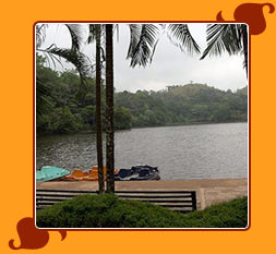
Wayanad District, in the north-east of Kerala , India ,
was formed on November 1 , 1980 as the 12th district, carved out of
Kozhikode and Kannur districts. The etymology of the word Wayanad is Vayal
(paddy) Naad (land); 'Land of Paddy Fields'. There are many indigeneous
tribals in this area. It is set lofty on the majestic Western Ghats with
altitudes ranging from 700 to 2100 Metres above mean sea level.
 Sightseeing
Highlights
Sightseeing
HighlightsTrekking to Chembra Peak (14 km SW) the highest point in
Wayand and Pakshipathalam along the Kerala-Karnataka border is arranged by
the DTPC. The freshwater Pookote Lake is a popular picnic spot and offers
enjoyable boat rides. You can visit the ancient Jain shrines-the
Anantnathaswami Temple and Koottamunda Glass Temple.
Sultan
Batthery (10 km E) which takes its name from Tipu Sultan, offers access to
the Eddakal Caves with their prehistoric carvings. The Muthanga (Wyanad)
Wildlife Sanctuary, to the east, is part of the Nilgiri Biosphere Reserve.
Advanced trekkers can venture into the Ambukuthy range. The Vishnu Temple at
Thirunelli (32km N) is a major pilgrimage point in the region. The Meenmutty
Falls, at their very best after the monsoons, lie 30km away from Kalpetta
which also offers quick access to the Suchipara and Kanthampara falls 22km
away.
Other ActivitiesPlan for a stay at
one of the beautiful plantation homes around the region. It's best to eat at
your place of stay as there aren't many exciting options in the townships.
Make time for tours around the wildlife sanctuaries and parks bordering the
region. The DTPC office arranges camping and guided tours in the region.
How to reach thereBy Air: Nearest
Airport is Kozhikode, 75 km from Kalpetta.
By Rail: Nearest
Railway Station is Kozhikode, 75 km from Kalpetta.
By Road:
Wayanad is well connected by roads from Kozhikode (75 km from Kalpetta),
Ooty (125 km from Kalpetta), Mysore (140 km from Kalpetta) and Bangalore
(280 km from Kalpetta).


